 While much of the 3D buzz at CES was about TVs and camcorders, I was equally impressed with a different kind of 3D.
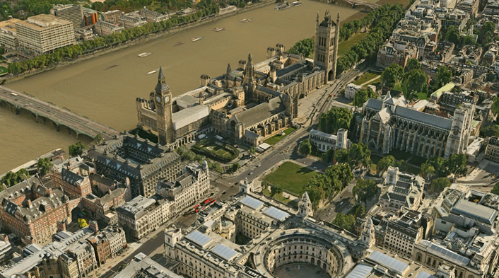
The Swedish company C3 Technologies demonstrated its photo-realistic 3D maps, which are likely turn up in next-generation mapping programs. So far they have maps of London, Barcelona, Stockholm, Copenhagen, Oslo, Boston, Miami, and San Francisco. By April, they expect to add another 22 cities.
How are these maps different from the ones you might find in Google Earth or your favorite GPS navigation program? They’re much more detailed and aren’t flat like your typical map. These maps are three-dimensional in the sense that you can zoom up and view each side of a building in great detail. The company might photograph a city using 200 separate flyovers in order to recreate the buildings and streets from any angle. Not surprisingly, C3 Technologies was spun out of the aerospace and defense industries.
The demo I saw at CES ran very smoothly with realistic shadows, colors, and shading. You can’t buy this technology at the moment, as the company is currently in the process of licensing the maps and rendering engine to software developers. The software development kit currently supports the Android, iPhone, and iPad. There’s also a Web kit for developing plug-ins for Firefox, Explorer, Safari, and Chrome.
It shouldn’t be too long before you can see – and explore for yourself – these incredible virtual cities.